
GAWP 2019 DAY-9
GAWP 2019 Day-9 questions are based on the topics and sub-topics as provided in the Week-3 schedule. With this we are about to complete half of the climatology syllabus. Today’s 5th question is based on the current affairs. 5th question is modeled as per upsc trend and requirement.
The detailed features and schedule of the program is here. Click
Previous day questions are here. Click
Q.1) On the outline map of India, mark the location of all the following. Write the significance of these locations, whether physical/commercial/economic/ecological/ environmental/cultural, in not more than 30 words for each entry.: (2 x 5 =10 marks)
- Ranganthittu bird sanctuary
- Pushkar lake
- Kovalam
- Ennore port
- Penner river
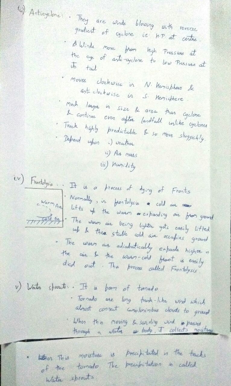
Q.2) Explain the following terminologies in about 50 words each: (5 x 5 =25 marks)
- Thunderstorms
- Tornadoes
- Anticyclone
- Frontolysis
- Waterspouts
Q.3) Compare the origin and weather conditions associated with the tropical and temperate cyclones. (2016) (20 marks)
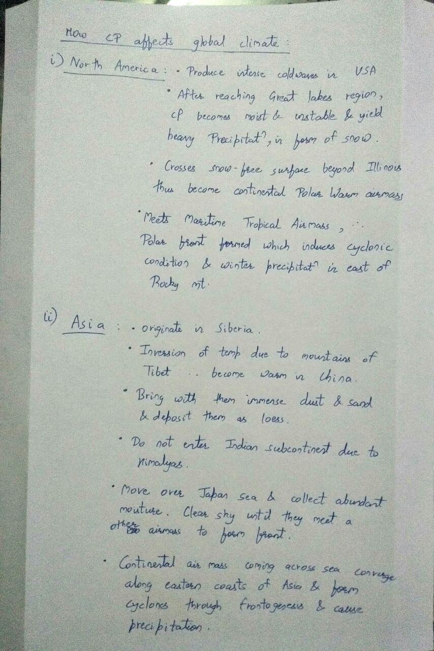
Q.4) Classify airmass and explain how ‘ cP ‘ airmass affects global climate (2012) (15 marks)
Q.5) Explain the drought scenario across India in the south-west monsoon period of the year 2018. (20 marks)
http://agricoop.nic.in/sites/default/files/Manual%20Drought%202016.pdf
Q.1) map location and write up excellent.
Q.5) Draw the drought prone map of India.
the write up and points are good.
write 3-4 points about the effects of drought.
Q2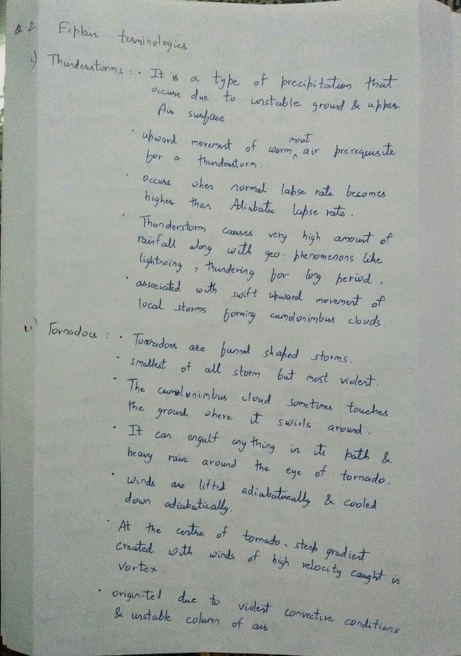
Good points… practice the diagrams of thunderstorms, tornadoes…
Q.2) The presentation of the concepts is very nice keep it up. Also write other terminologies
Q.3) Needs more explanation about origin…
comparison of weather associated is good.
improvise the definition of cyclone.
tropical cyclone…. mention… existence of weak tropical disturbances.
upper level outflow.
weak vertical wind shear.
small atmospheric vortices in ITCZ.
temperate cyclone.
write the origin in stages like initial stage, incipient stage, mature stage and occlusion stage.
mention Baroclinal wave theory.
[…] The detailed features and schedule of the program is here. Click […]
Q4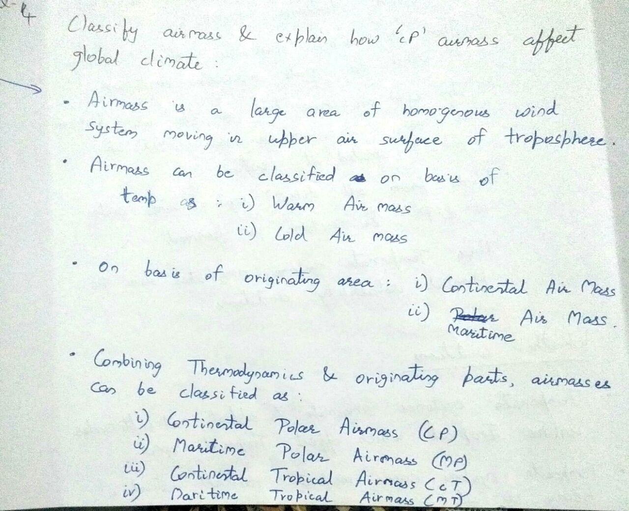
cP in N. America
mention lake-effect snow.
formation of dense fogs due to formation of fronts.
write the impact of cP airmass on Europe.
Q.1) Draw full Indian map. Write few more points for each map entry. 30 words is the limit.
Q.2)
2. tornado…. define tornadoes. then write about it features.
rest of the write ups are good.
Q.4) in the classification some of the letters not been defined. for example cPKS in this the k and s are what?
write how cP airmass affects the climate in N.America, Asia n Europe.
Q.5) draw the drought prone are map of India.
we are not sure about IMD classification about ‘deficit area’ and ‘large deficit area’. If you have any reference please post in the comment box.
in conclusion sentence formation is wrong.. have a look at it.
otherwise answer is written very nicely.
categorization from IMD is as follows… refer page number 8.
http://imd.gov.in/section/nhac/termglossary.pdf
That is correct… don’t use area in front of the category it leads to confusion. It is categorization of rainfall not area.
Sir, shall I draw flowchart in geography optional writing as like gs answer writing???
Yes you can… It makes the answer presentation more effective.